MAPS
Updated 11/07/2023
|
MAPS are an important part of history. This form of research provides vital information regarding names, locations and size of geographical sites. They provide perspective, guidance and direction. Even modern maps play a role in historic research when compared to vintage maps, allowing us to visualize what used to be against what is currently present. Auburn has many maps available, both past and present, both professional and amateur. Some of these maps are provided here as a source of reference. If you have access to other maps which you believe might enhance this web page, please inform us of your potential contribution by using the "Visitor Input" option on this website. |
NOTE: If you have any historic information and/or pictures that are relevant to this webpage topic, please share it with us by submitting the material using the "Visitors Input" button below. Thank you!
AUBURN (TOWN-WIDE SCALE)
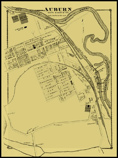
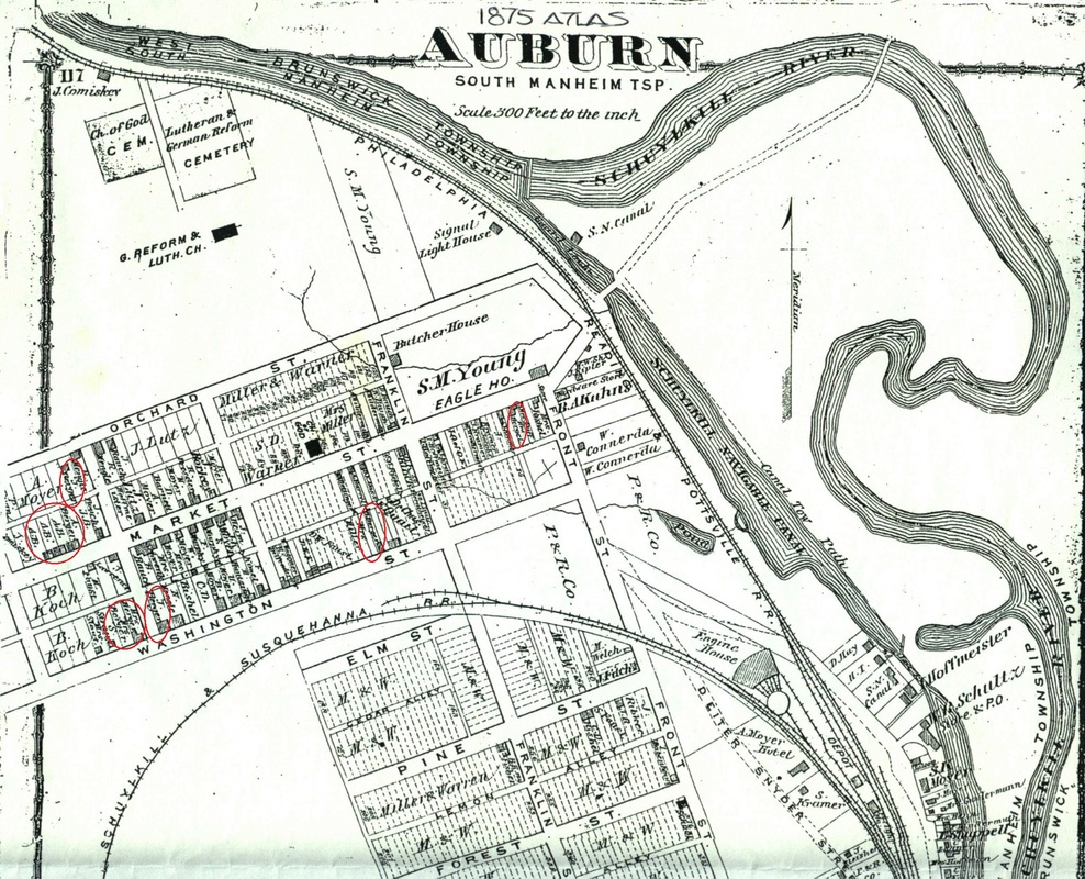
1875 DeBeers Map of Auburn, PA - Posted 12-10-2015

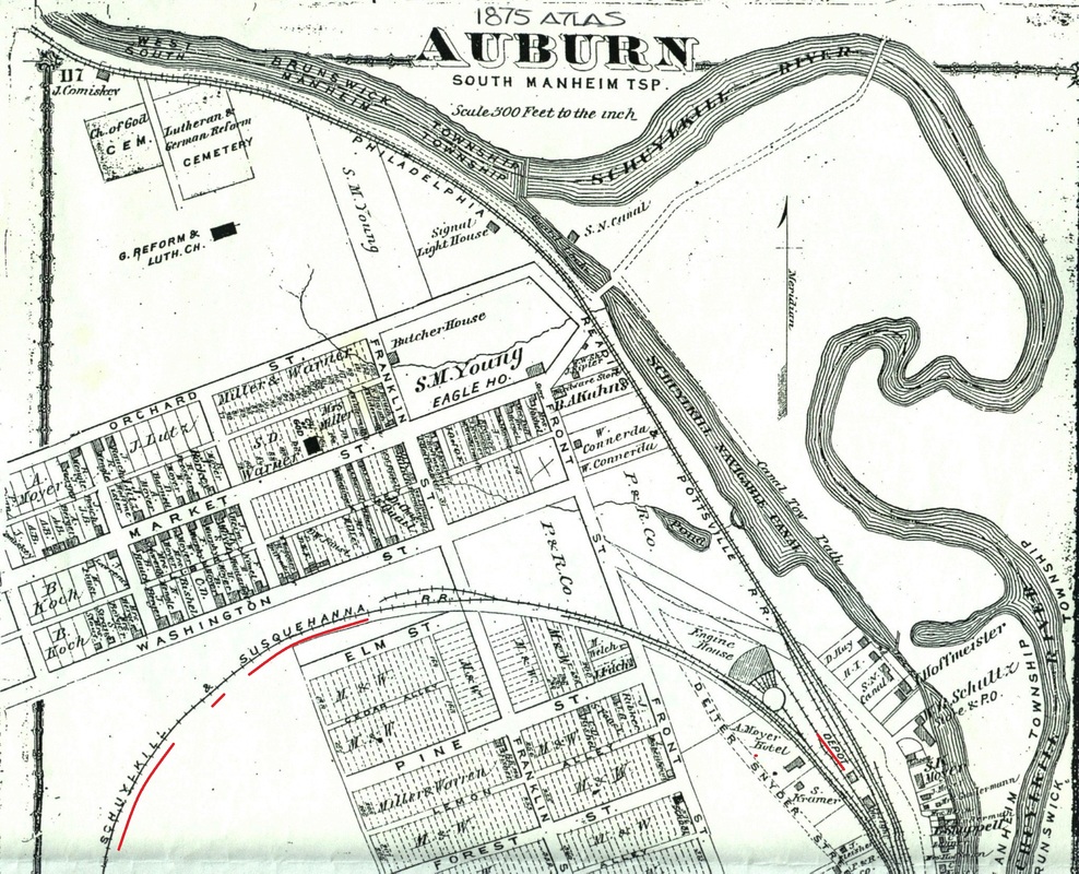
1875 DeBeers Atlas enlargement of Auburn, PA - Posted 12-10-2015
BEAR CREEK STREET
Vintage map circa 1930s depicting a portion of Bear Creek Street (northern section) (Posted 10-30-19)
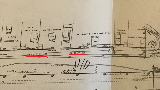
Vintage map circa 1930s depicting a portion of Bear Creek Street (center section) (Posted 10-30-19)
Vintage map circa 1930s depicting a portion of Bear Creek Street (southern section) (Posted 10-30-19)
CANAL STREET
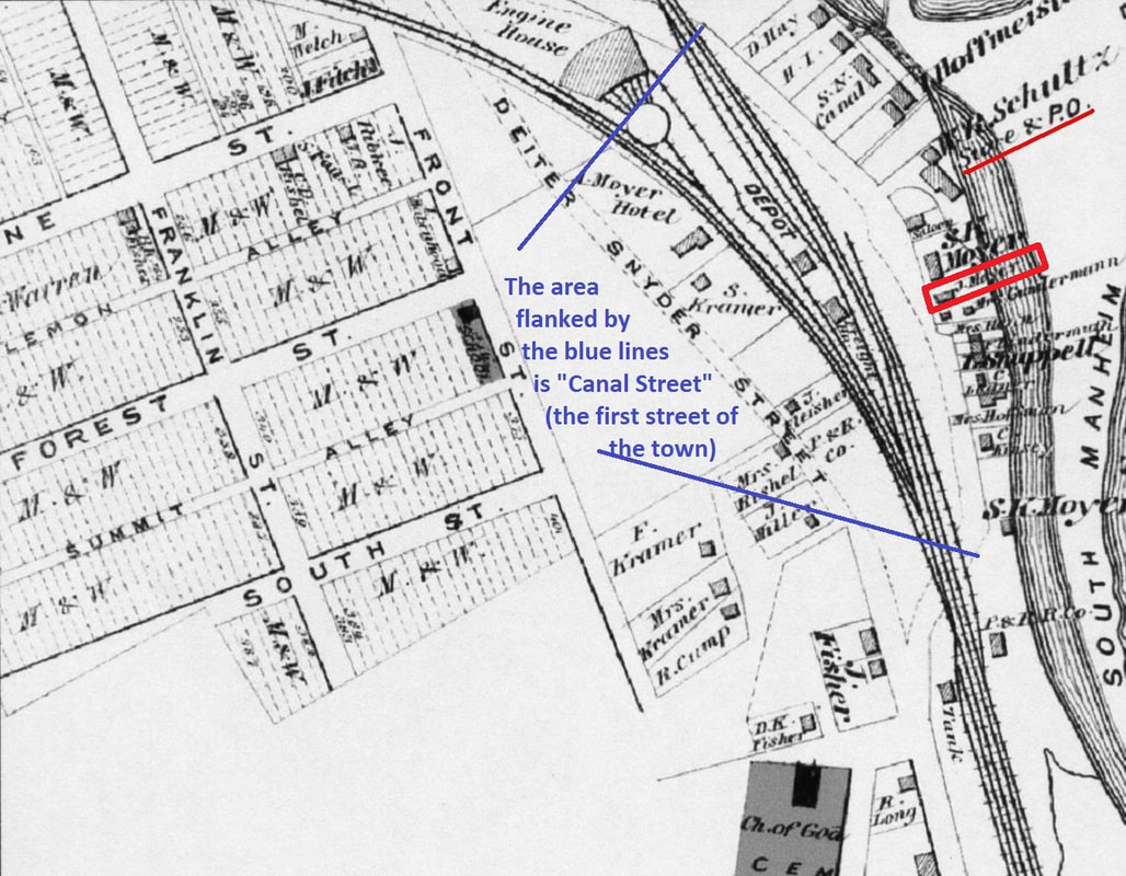
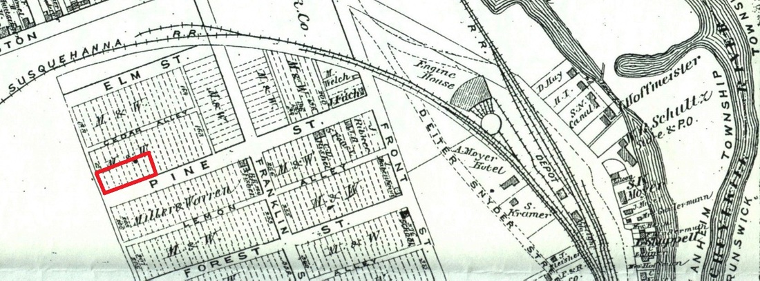
A portion of the 1875 DeBeers Atlas map for Auburn, PA which delineates the section of roadway called Canal Street. (Posted 10-30-19)

A vintage map (circa 1930s) showing a portion of Canal Street, Auburn, PA. (Posted 10-30-19)
CEMETERIES
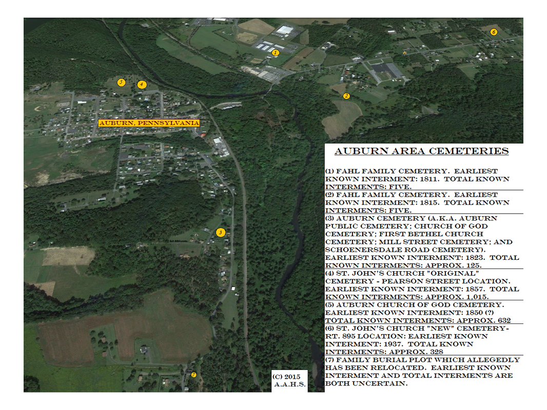
Auburn area cemetery locations - Posted 12-11-2015
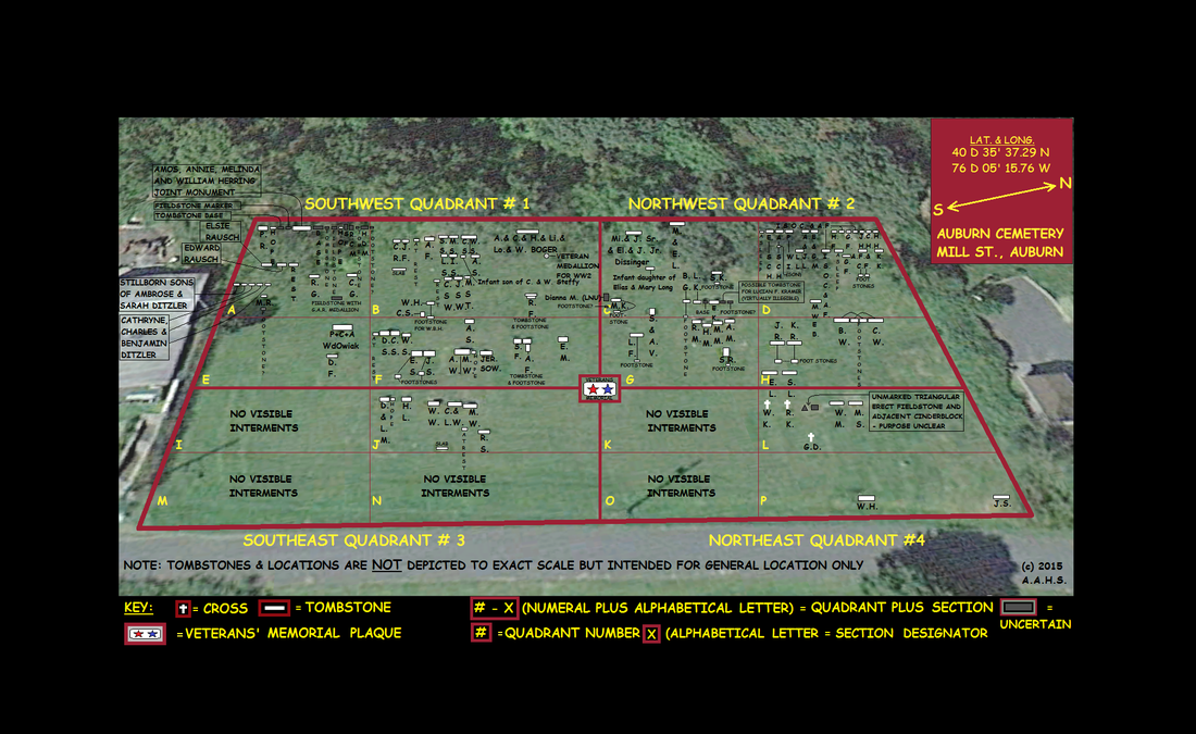
Auburn Cemetery interment map - Mill Street location - Posted 12-11-2015
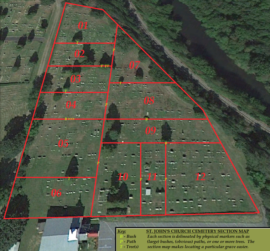
St. John's Church cemetery section map - Pearson Street location - Posted 12-11-2015
DEITER/DIETRICH SNYDER
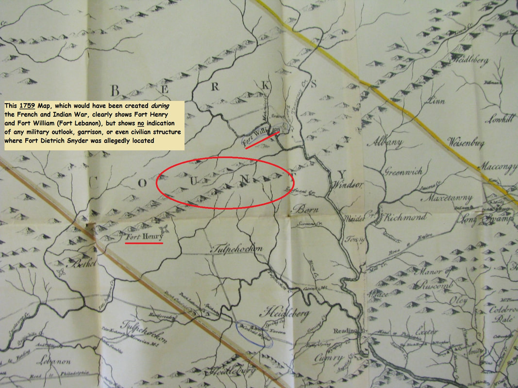
1759 Map depicting absence of "Fort Dietrich Snyder". Posted 01-14-2018

1776 map (reproduction) of Berks County (which then included most of what would later become Schuylkill County) showing a "tavern" in the approximate area of the site - Posted 05-22-2017
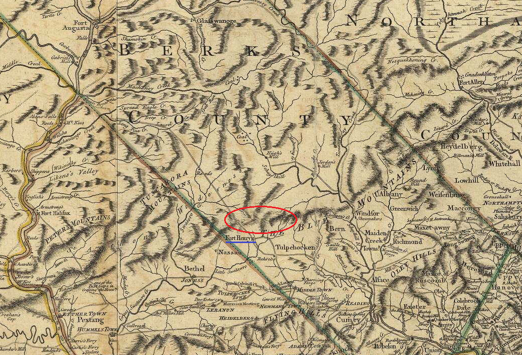
1777 Map of Berks County depicting absence of "Fort Dietrich Snyder" - Posted 01-12-2018
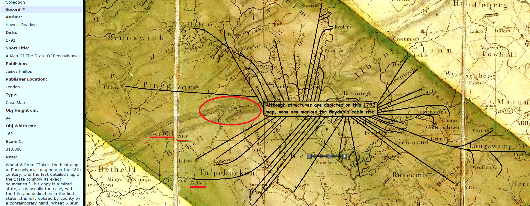
1792 Map of Pennsylvania portion in which Dietrich Snyder's cabin is absent. Posted 01-14-2018
1792 Map of Berks County in which Dietrich Snyder's cabin is absent. Posted 01-14-2018
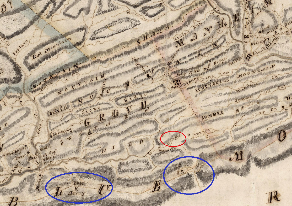
1811 Map showing structure with notation of "Snider" inside blue circle on the right. Posted 01-14-2018
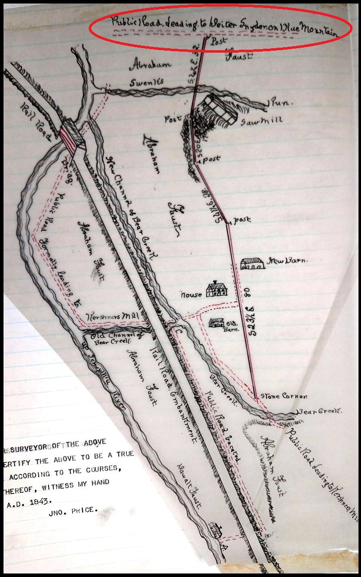
1843 Map with inscription "Public Road leading to Deiter Snyder on Blue Mountain". Posted 01-14-2018
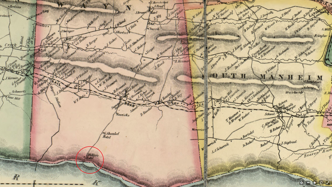
1863 - Miller's Hotel depicted in circle. Posted 01-14-2018
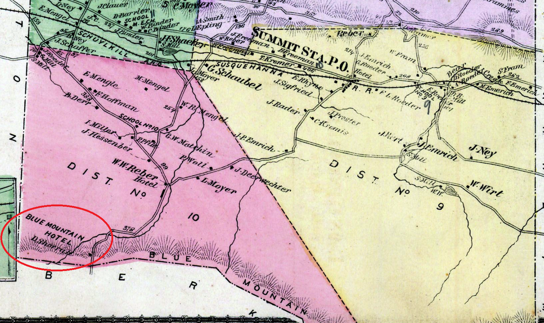
1875 - Blue Mountain Hotel depicted in circle. Posted 01-14-2018
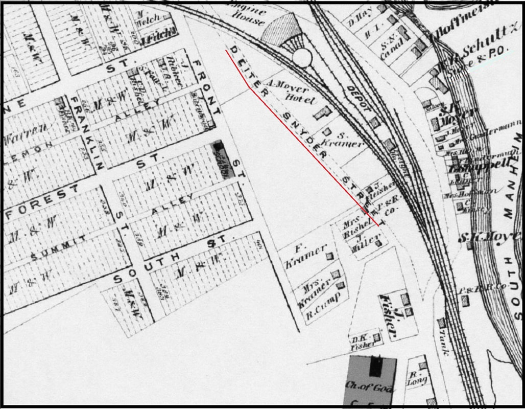
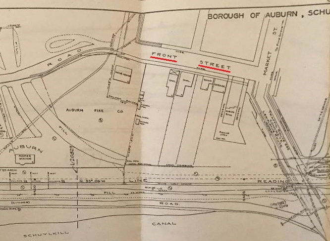
1875 DeBeers Atlas map of Auburn enlargement featuring "Deiter Snyder Street". Posted 01-14-2018
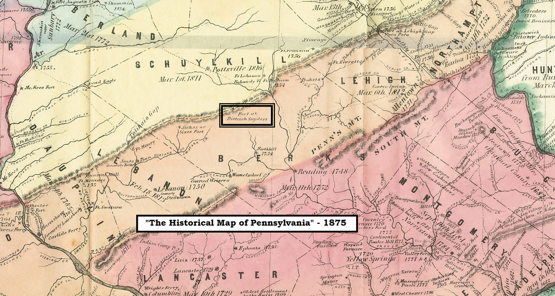
1875 Map - "Historical Map of Pennsylvania" showing Fort at Dietrich Snyder's. Posted 01-14-2018
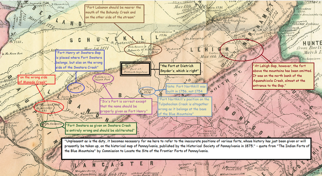
1875 Map - "Historical Map of Pennsylvania" showing numerous incorrect entries. Posted 01-14-2018
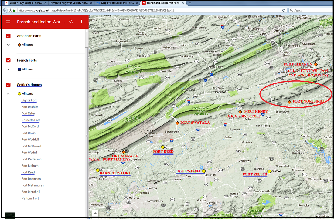
2017 download of modern map depicting Frontier Forts and settlers' homes during the French and Indian War...Dietrich Snyder's is noticeably absent. Posted 01-14-2018
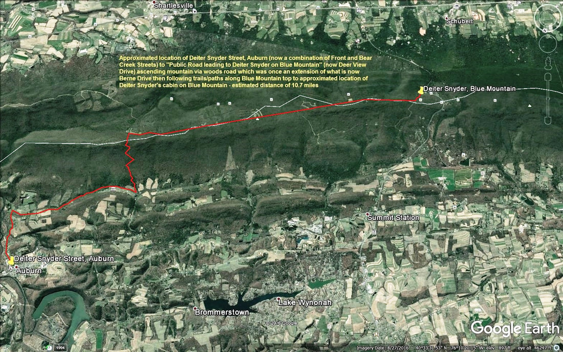
2017 Satellite View Map of approximate path from Deiter Snyder Street of Auburn to Dietrich Snyder's cabin on Blue Mountain. Posted 01-14-2018
FRONT STREET

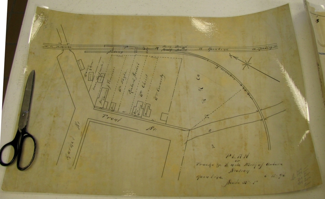
An 1896 map depicting Front Street, Auburn, Schuylkill County, PA. (Posted 10-30-19)
A vintage map circa 1930s showing Front Street, Auburn, PA. (Posted 10-30-19)
MISCELLANEOUS HISTORIC SITES

Date Unknown - crude hand-drawn map of approximate location of Fort Lebanon in Schuylkill County. Posted 01-14-2018
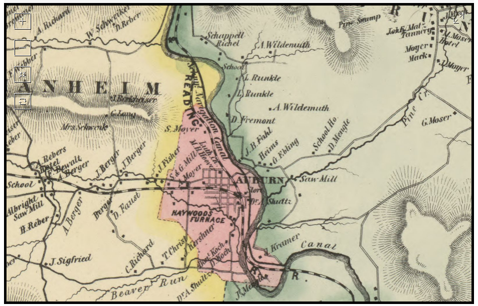
1863 map depicting Haywood Furnace south-southeast of Auburn - Posted 05-22-2017
PLACES OF WORSHIP

Auburn's Religious Places of Worship-Past and Present-Posted 12-10-2015
|
POST OFFICES

Post Office location circa 1875 - Posted 12-10-2015
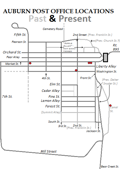
circa 2012 - Auburn's Post Office Locations - Past and Present - Posted 05-22-2017
PROPERTIES BY SURNAME
Berger properties as of 1875 - Posted 12-10-2015
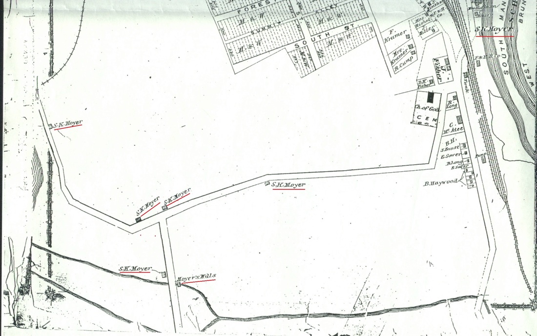
1875 DeBeers Atlas Map enlargement featuring properties of S. K. Moyer - Posted 12-10-2015
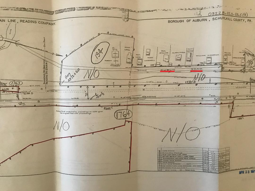
RAILROADS
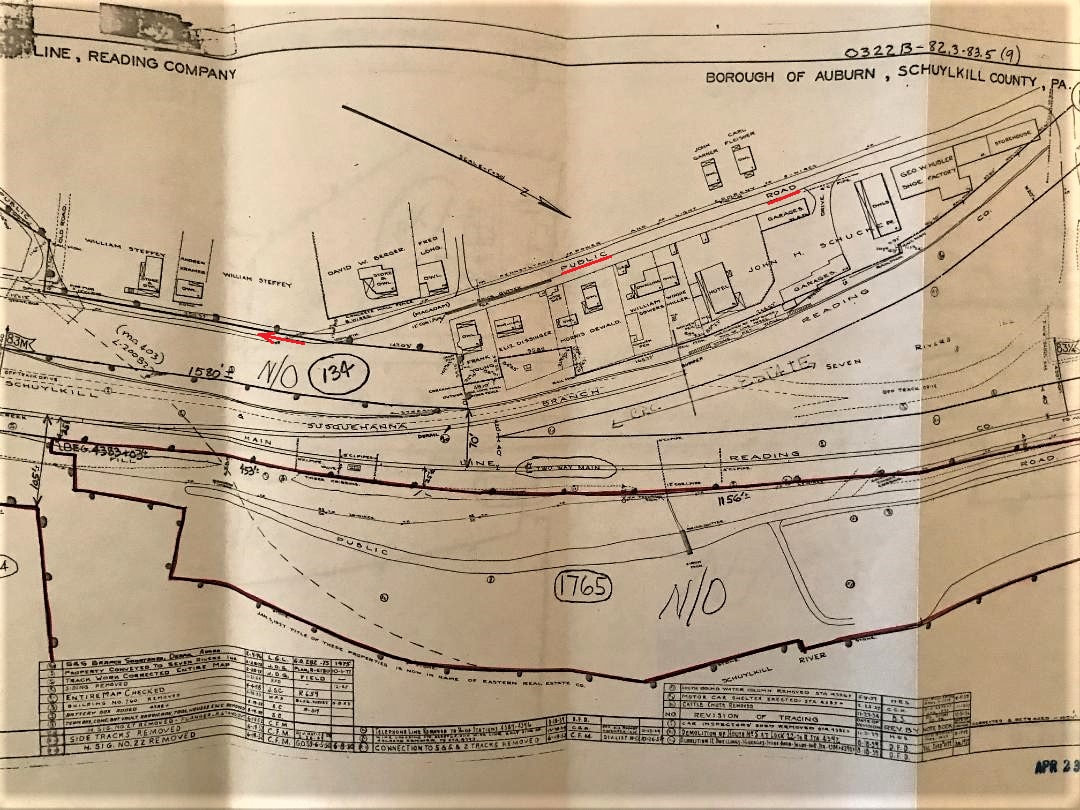
Dauphin and Susquehanna Railroad through Auburn, PA - date uncertain. Posted 01-14-2018
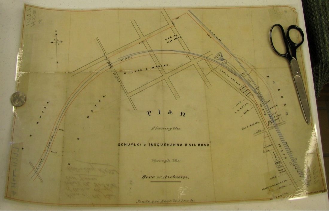
Schuylkill and Susquehanna Railroad Map 01 - Posted 05-22-2017
1896 Railroad Map of Auburn area - Posted 05-22-2017
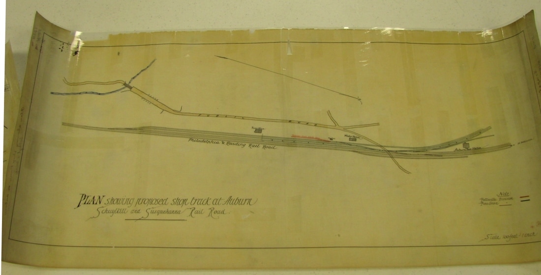
Schuylkill and Susquehanna Railroad Map 02 - Posted 05-22-2017
Schuylkill and Susquehanna (S & S) Railroad location circa 1875 - Posted 12-10-2015
SCHOOLS
Front and Forest Street school location circa 1875 - Posted 12-10-2015
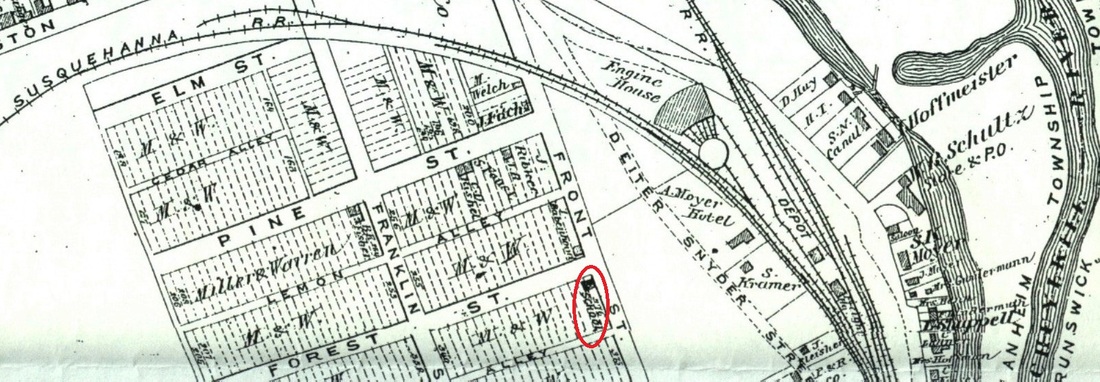
Future site of the Pine Street School location as featured on 1875 map - Posted 12-10-2015

circa 2012 - Auburn's Prior Educational Locations - Posted 12-10-2015
SCHUYLKILL NAVIGATION SYSTEM
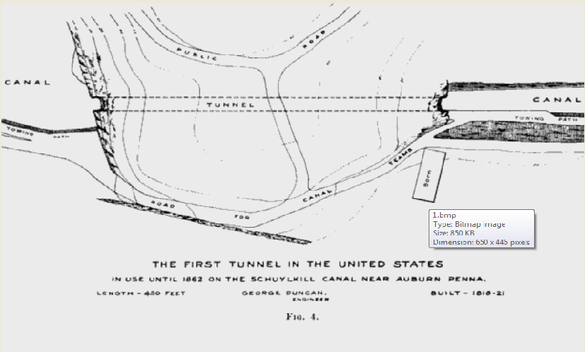
Schuylkill Navigation Tunnel map - Posted 12-10-2015

1826 - Schuylkill Navigation System Tunnel depicted - Posted 05-22-2017

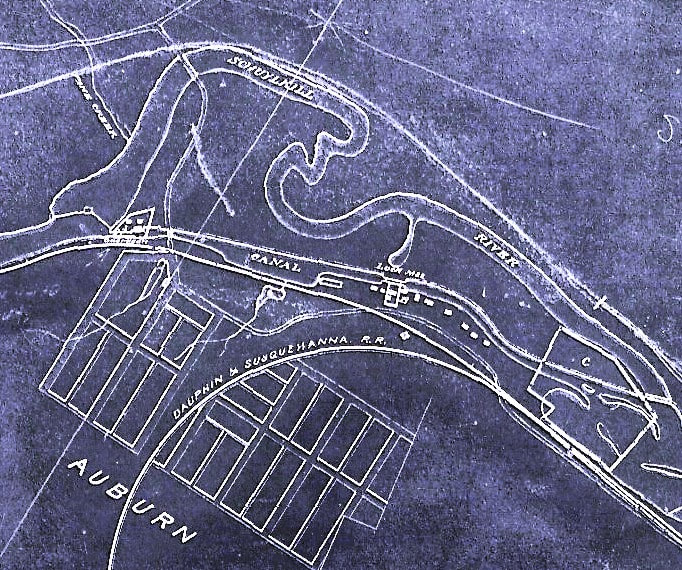
mid - 1800s - Schuylkill Navigation System blue-print map - Posted 12-10-2015
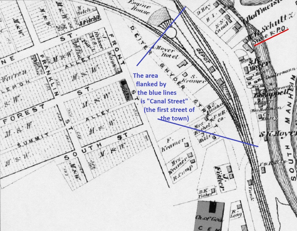
Canal Street of Auburn circa 1875 - Posted 12-10-2015
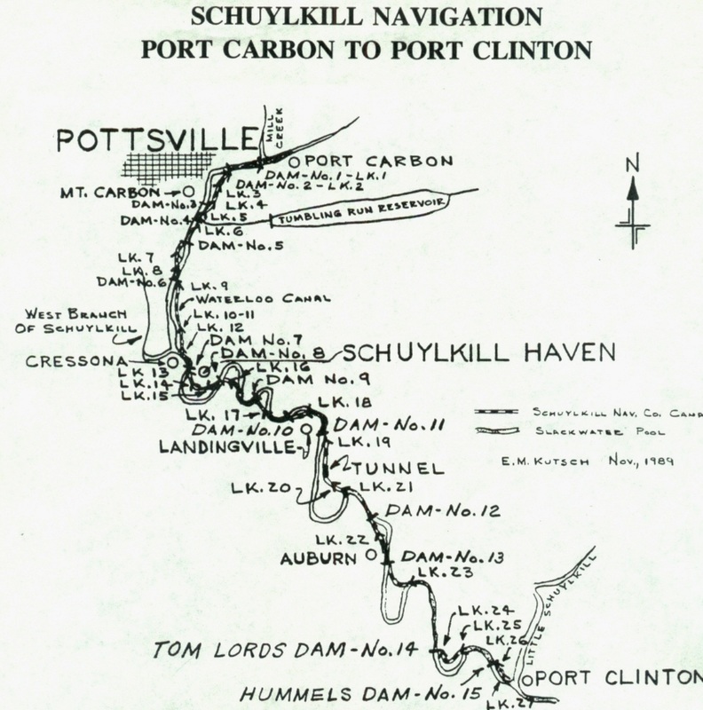
Schuylkill Navigation System map - Port Carbon to Port Clinton - Posted 12-10-2015
SCOLLOP (SCULPS) HILL
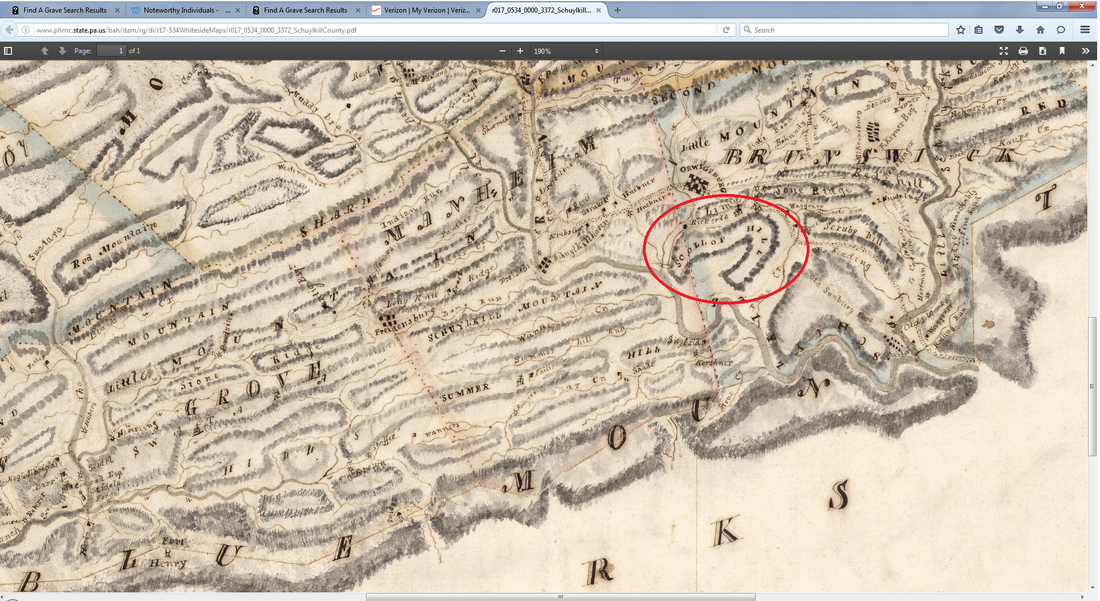
1817 Map depicting Scollop (later Sculps) Hill - Posted 05-22-2017
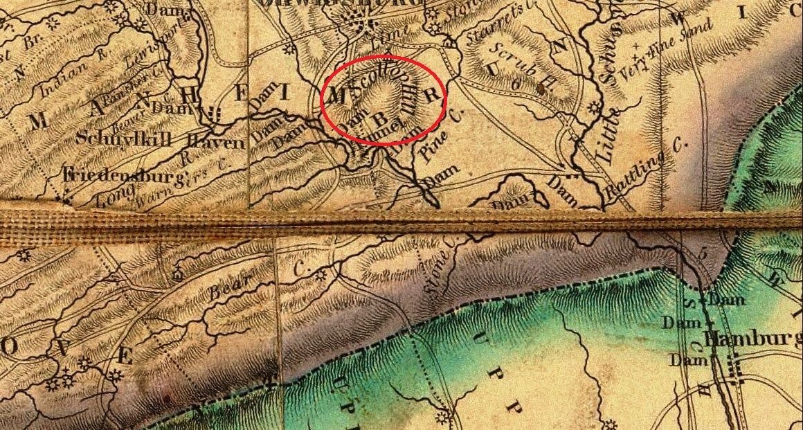
circa 1826 map depicting Scollop (later Sculps) Hill - Posted 05-22-2017
STREETS

circa 1855 - Proposed "new" route of Market Street of Auburn, PA (NOTE: Auburn wasn't officially established until 1857 but the name of "Auburn" for the town was proposed in 1842) - Posted 05-22-2017

circa 2005 - Auburn Streets - Posted 05-22-2017
circa 2005 - Auburn Streets - Posted 05-22-2017
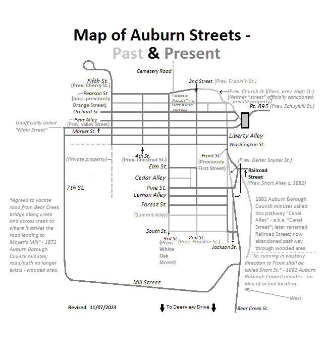
2023 - Auburn Street Map - Past and Present - Updated 11/07/2023
TOPOGRAPHIC

1940s Topographic Map of Auburn - Posted 12-10-2015
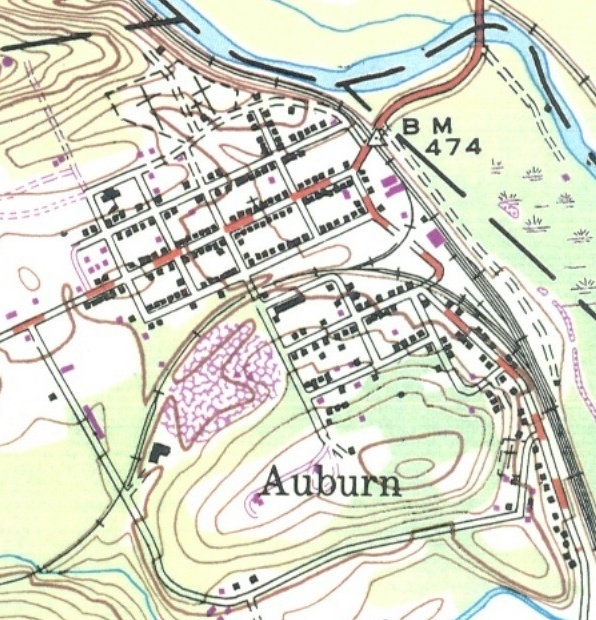
Topographic map of Auburn - date uncertain - Posted 12-10-2015

Distant topographic map of Auburn - Date uncertain - Posted 05-22-2017
TOWNSHIPS OR COUNTY
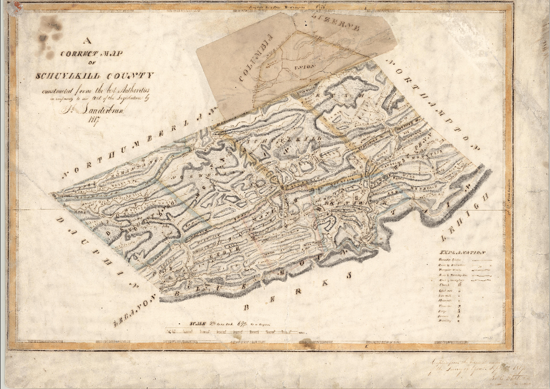
1817 Map of Schuylkill County. Posted 01-14-2018

(post) 1866 Map of Schuylkill County Townships. Posted 01-14-2018
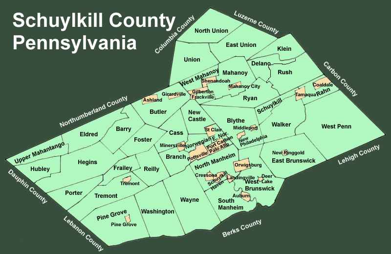
2017 download of modern Schuylkill County Map. Posted 01-14-2018
|
